A Comparison of Hurricane Isaac’s Track and Historical Hurricane Katrina Track
As Hurricane Isaac approaches the Gulf Coast today, the track Isaac is taking is eerily similar to the track Katrina took seven years ago at this same time. Although Isaac is not nearly as strong or expected to cause the extent of damage that Katrina did, many Gulf Coast cities are ordering evacuations. I wanted to see just how close the tracks of the two storms are, so I overlayed Isaac’s track with the historical track Katrina took in 2005. Isaac is expected to hit the Gulf Coast within hours of the seventh anniversary of Katrina.

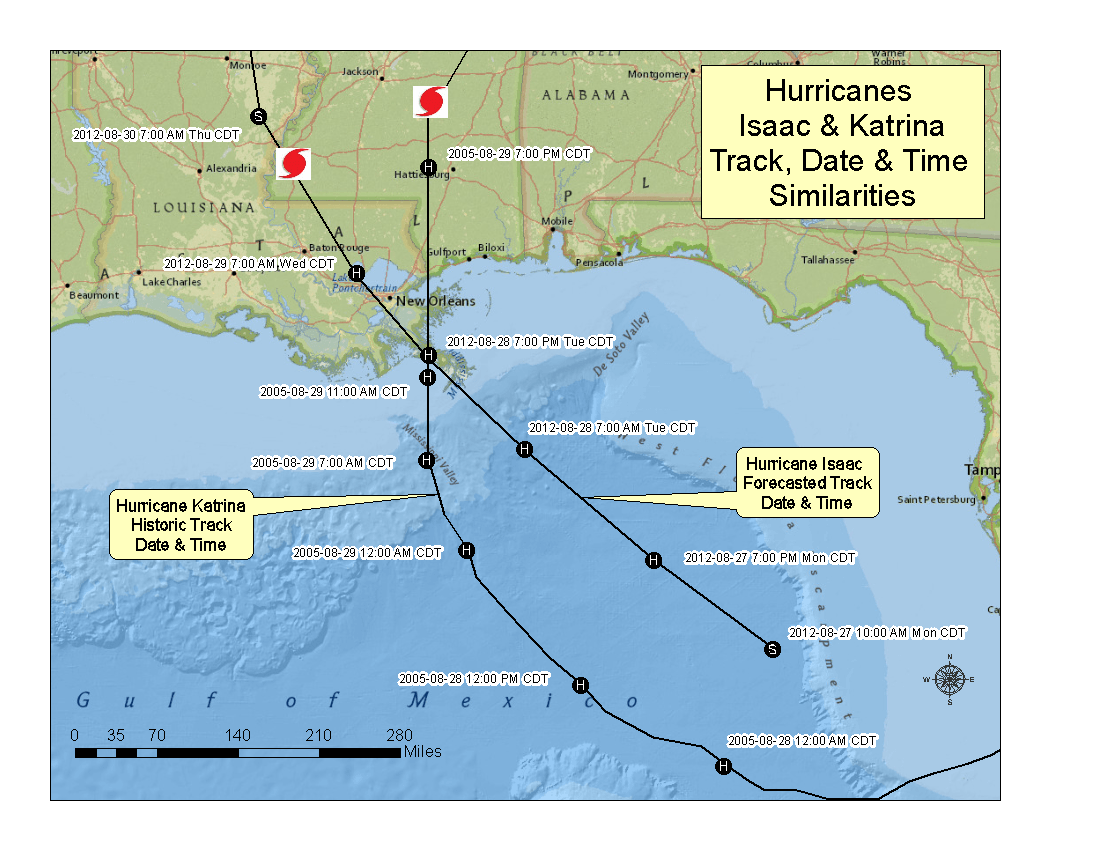
This map depicts the forecasted track of Hurricane Isaac and the historical track that Hurricane Katrina took seven years ago almost to the exact date and time. They are approximately 12 hours apart. The lines indicate the center track of each tropical cyclone and where Isaac is forecast to be as it makes landfall. As you can see from the map, Isaac is expected to make landfall at almost the same spot Katrina did.
The black forecasted and historic track lines of both storms do not reflect the fury and intensity of wind or the level of storm surge associated with a hurricane. Nor does this map give any indication of the impacts on residents from a hurricane.
The direction the winds will be coming from and the subsequent storm surge between the two storms are sure to be different, and the results have yet to be determined with any absolute certainty. One certainty is that a tropical storm or hurricane will hit the Gulf coast and that residents should be prepared.
Related Material:
Economic Losses from Hurricane Isaac Could Reach $21 Billion
Hurricane Isaac Social Media Resources – Disaster Social Network
IEM Modeling & Simulation Capabilities
Author: Eston Spain, GIS Analyst & Emergency Planning Associate

