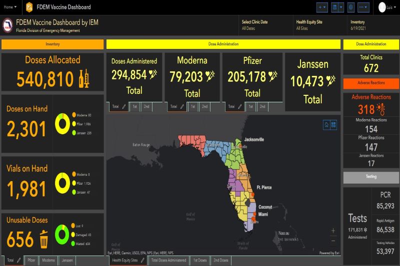
IEM Innovative Geospatial Technology: Pandemic Response & Mitigation
Geospatial information systems (GIS) are valuable tools to gain a greater understanding of where vulnerabilities exist and what actions to take to become more resilient. IEM uses innovative GIS technology to support our public health and pandemic response initiatives as well as to inform emergency managers of potential hazards and their consequences.


